BROWN STONE QUARRY, WADESBORO, NC
One of my friends Ralph Henry Coble from our early
Church days, proprietor of
Lord George Anson Antiques here in
Wadesboro, NC asked me a year or so ago to help him locate the Brown Stone
Quarry here in Wadesboro, NC located off Highway 52N. Ralph is a local
history buff, talented musician and into genealogy. Richard Harrington, surveyor provided
him with a GIS Satellite image of where the property is located. We finally
got our schedules on the same sheet of music and went on a hunt and seek mission to locate the
Brown Stone Quarry the morning of June 5, 2019. I do realize
brownstone is typically spelled as one word!
I related to Ralph earlier, that I remember going to the rock quarry back in
the middle to late 1950s while doing my normal ramblings that
young boys do and the
quarry had a pond and a steep rock wall on the back side of the quarry,
whereas it was told to me then, that it was the ole rock quarry that had been
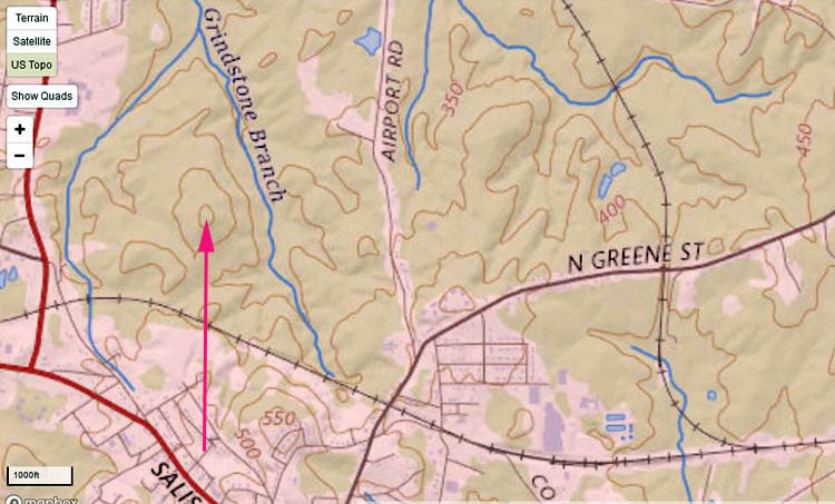
abandoned many decades ago.GIS AERIAL VIEW OF THE
QUARRY IN 2015
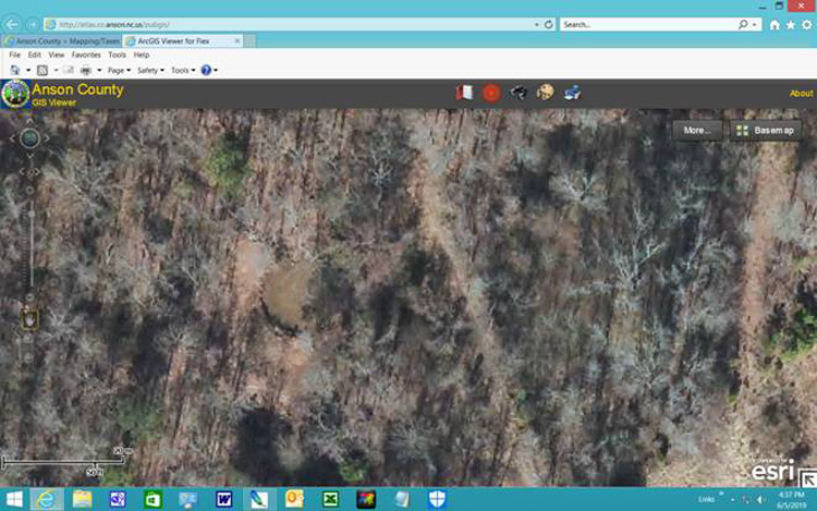
I screen captured the above pixs from the Anson County GIS viewer.
The brown circle to the left of center in the first pix is the actual quarry
site which is a pond and as I remember it back in the middle to late 1950s.
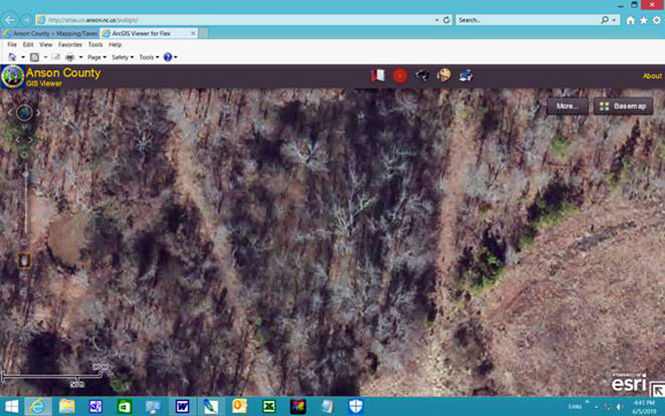
I will post additional pixs taken after the history section.
BROWN STONE QUARRY HISTORY
The below is a copy and paste of an article in the Messenger-Intelligencer
dated March 15, 1917:
Messenger-Intelligencer issue of Thursday, March 15, 1917 Page 1 – Brown
Stone Quarry to be Opened – Mr. John T. Patrick has contracted with a large
building contractor of Atlanta, Georgia in order to open up the brown stone
quarry known as the courthouse quarry, which is owned by Mr. Patrick.
Specimens of this stone that were quarried many years ago are to be seen
around Wadesboro. The stone was used for the foundation of the old
courthouse & wears remarkably well.
It is as good brown stone as can be found in North Carolina. It is
understood that the stone will be shipped to Atlanta & elsewhere in large
quantities. Employment will be given to a number of men by this
development.
HISTORY OF ANSON COUNTY, NORTH CAROLINA 1750 - 1976
Below is published in Mary Louise Medley's book titled History of Anson County,
North Carolina 1750 - 1976 page 168,
"Brownstone Operations"
A second kind of mining was carried on in Anson in the late nineteenth and
early twentieth centuries, the quarrying of brownstone. Two quarries
are cited in an article by Thomas L. Watson and Francis B. Laney, "The
Building and Ornamental Stones of North Carolina," in the North Caroline
Geological Survey Bulletin No. 2, published in Raleigh in 1906.
One of the quarries was operated by John M. Linehan and the other by W. A.
Polk. The old Linehan quarry was about one and a quarter miles
northwest of Wadesboro, a short distance from the Seaboard Air Line Railway.
The W. A. Polk quarry, formerly the Wadesboro Brownstone Company, is
reported to be the one that furnished the local brownstone appearing in some
of the illustrations. Brownstone was used extensively as a building material
in 1889 and 1890. The Polk quarry was about one and a half miles
northwest of Wadesboro and furnished two colors of stone, red-brown and
light brown. "Stone from this quarry was used in the post office
building and federal court buildings
in Wilmington, Ashville and Statesville; YMCA in Charlotte and Atlanta, and
in the Garrett School Building of Baltimore," the article states.
Industrial Growth
The exterior brownstone trim of the Governor's Mansion in Raleigh has been
identified as Anson County Brownstone, but was not mentioned in the article.
The North Carolina Governor's Mansion drew compliments from the late
President Franklin D. Roosevelt, who described it as "the most beautiful in
America." Governor Daniel Fowle was the first to live in the mansion.
The town of Wadesboro has many examples of this fine building stone today,
including the Thomas Wade D.A.R. War Memorial Drinking Fountain at the
corner of Wade and Green Streets East. The square in which it sits is
now a lovely garden for all seasons, maintained by Wadesboro's Ola Kala
Garden Club. The memorial honors those who served from the Revolution
through World War I.
The brownstone wall placed around Calvary Episcopal Church in 1920 to mark
its centennial observance enhances the earlier brick building. Women
of the church were responsible for the projects.
A carved piece of brownstone with the letters B/C entwined is found at the
Martin Street entrance to the education department of the Wadesboro Baptist
Church. It was part of the earlier brownstone and brick church at the
corner of Wade and Rutherford streets, which is said to have been build with
stone fragments from a local quarry.
The foundation for the home of Mrs. Bessie Colson on Morgan Street is also
constructed of this fine enduring native stone. Mrs. Lila Martin has a
water trough carved from local brownstone in the yard of her north Wadesboro
home.
Hand-book of North Carolina by NC Dept. of Agriculture by John D.
Cameron page 294
The below article is the best description of the operation of the Brown
Stone Quarry that I have located to this date which details equipment usage,
etc.:
"In Anson County is the Wadesboro Brownstone Quarry, one mile north of
Wadesboro on the
Carolina Central Railroad. The stone is quite hard
and uniform, of a light chocolate-brown in a grayish-brown color, and of
fine to medium texture, the lighter colors being usually coarser. The
quarry was opened in 1887, and was worked until June, 1891. The quarry
face is about 150 feet long by 30 feet high, though much of this face and
the material which has been quarried is worthless cap-rock and soil.
The cap varies in thickness from..to 15 feet. Quarrying is very much
facilitated by natural jointings and bedding, and blocks 8' x 8' x 8', and
smaller, are easily obtained. From 40,000 to 50,000 feet of stone have
been quarried. The stone dips S. E. 20 degrees and the quarry faces
almost due west. All stone was sawed either at the quarry or shipped
rough; dimension stone, 75 cents per foot, sawed two ways, $1; four
ways, $1.25. It was used principally for trimming brick buildings.
Specimens of it may be seen from Atlanta to Baltimore, notably the United
States Court-houses and Post-offices at Wilmington, Asheville and
Statesville, N. C., the Young Men's Christian Association buildings at
Charlotte and Atlanta, the Garrett School building at Baltimore, and the
Baptist Church at Wadesboro. A steam-pump was constantly employed to
drain the quarry, and in rainy weather work would sometimes be suspended for
a month on account of flooding. The machinery connected with the
quarry consists of two boilers, an engine of about 50 horse-power, five
gangs of saws, steam-drill, one steam-power derrick of fourteen tons
capacity, and two horse-power derricks. The full force employed was
about sixty workmen." It appears that reorganization of the Brown
Stone Quarry Company eventually led to its demise.
NOTE: According to Mary Louise Medley, the Wadesboro
Brownstone Quarry later became the W. A. Polk quarry which occupied the same
site.
PICTURES TAKEN OF THE QUARRY SITE
Ralph Coble picked me up around 8ish this morning and it was extremely
humid to say the least. I got my ole straw hat, hunting boots on and a
home made sweat band which definitely came in handy to keep the sweat out of
my eyes. I had my hiking pole and a little Ruger .380 LCP for snakes,
etc. Ralph had the print out that Richard Harrington gave him
and we parked at a private drive way off the old 52 N road on the other side
of the railroad underpass. We walked to the end of the gravel drive
way and tried to get someone to come to the door of the home to let them be
aware of our presence, but no one
came to the door. The access road that leads in the vicinity of the
Brown Stone Quarry has a locked gate, but we walked around it.
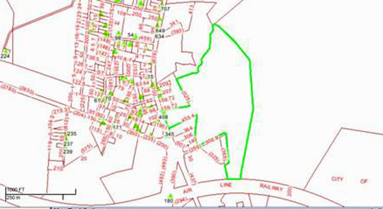
Below is a copy of the GIS print out that Richard Harrington gave Ralph:
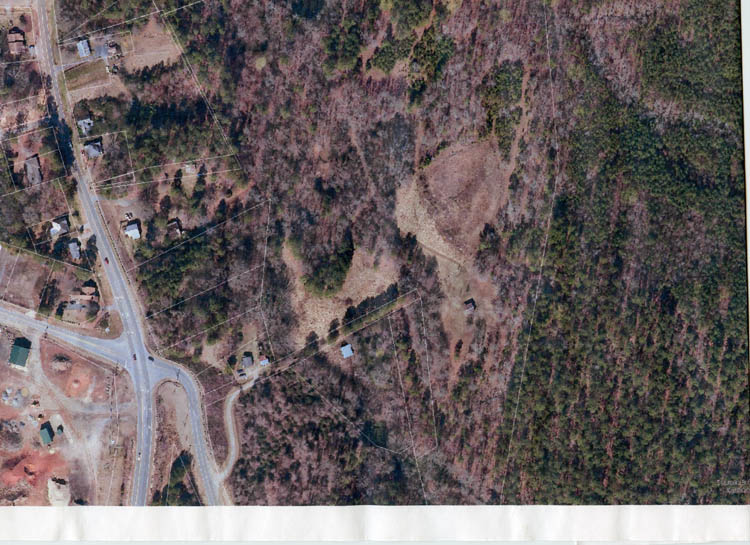
Ralph parked his car as stated above near the main road at the gravel
access drive way to a private dwelling. We walked the access road to the
last building to the right of the center below the clearing, but in the past
four years, it is over grown. Also, the trees to the right have been
clear cut and an area locals called Carl's Mountain, not
Carr's
Mount was visible to the right. The elevation of Carl's Mountain is
464 feet above sea level per an earlier topo map I had access to. The
Carl's Mountain land is owned by Shirley Lawson Ratliff of Jacksonville, AL.
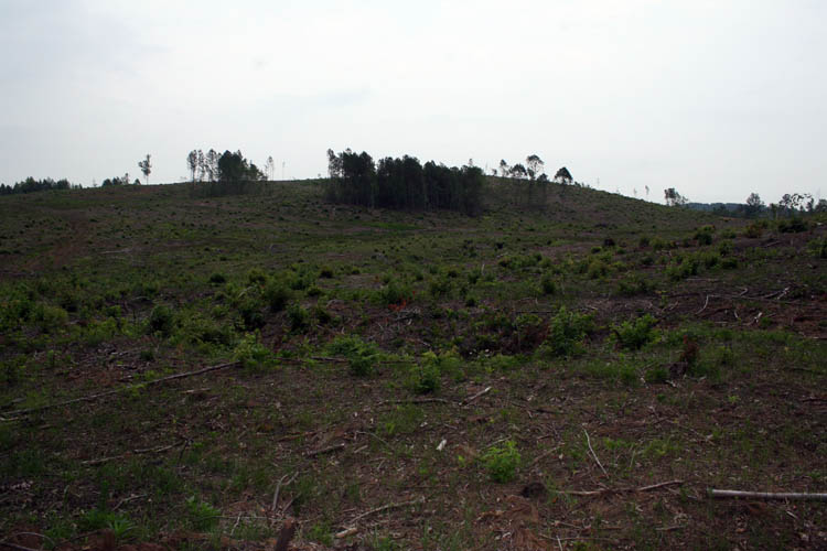
TOPO VIEW OF CARL'S MOUNTAIN
The pinkish arrow in the above pix is pointing to the
crest of Carl's Mountain. The blue arrow in the above pix is pointing to the
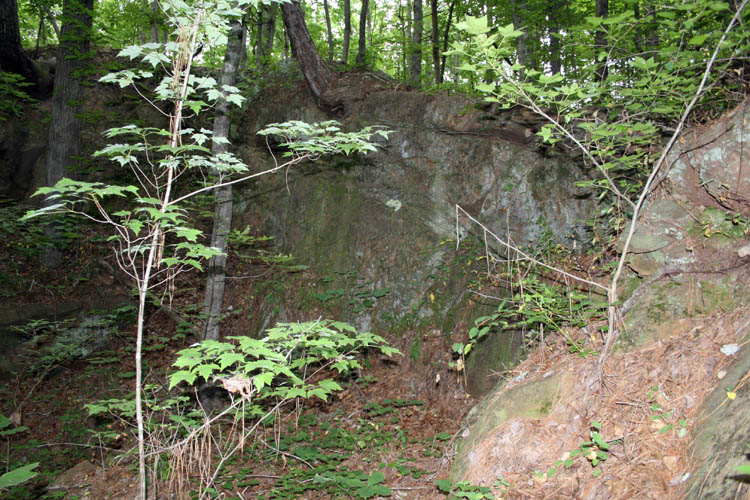
crest of Carl's Mountain. We made a large circle and followed a dry creek bed and crossed several
dirt trails/roads and finally came to a pond which later proved to be the actual site of
the quarry. The reason I am sure other than going from memory from the
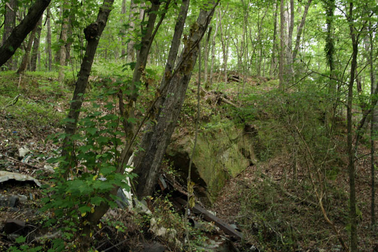
late 1950s, was evidence of the humongous brownstone rocks and the cliff
wall that was at least 30 feet to the east of the pond. I also found
and documented evidence of a couple large stones that had drill marks paths
from 1 to 3 inches in diameter and several feet in length and definitely was
made by a powered drill of some type.
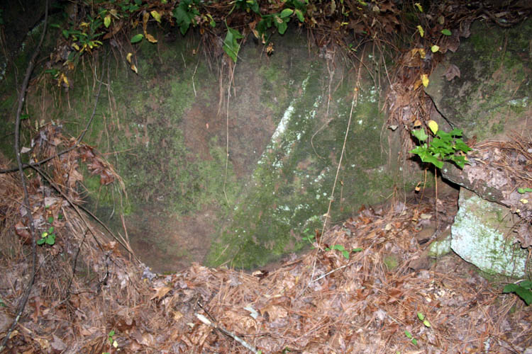
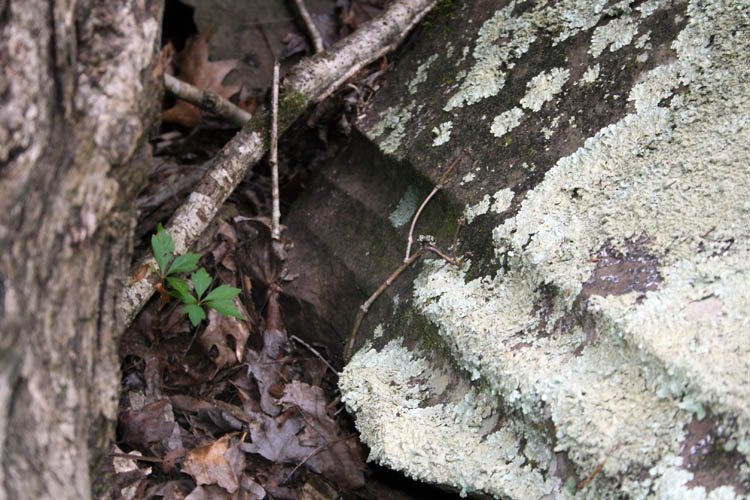
The height of the above stone is at least six (6) feet. There are
two parallel drill marks going the entire height of the stone at an angle
and at least 1 inch in diameter. In all probability, the large stone
has shifted and no doubt the drill originally was in a vertical orientation;
just a guess at the best!
Those stones are huge for sure.
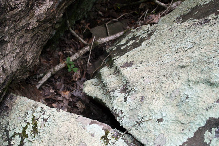
The above is a stone with about a three (3) inch diameter parallel drill grooves.
Those straight, half moon shaped and parallel grooves are definitely man made for sure!
The above brown stones might have been rejects and the stones
encompass a larger area adjacent the quarry pond.
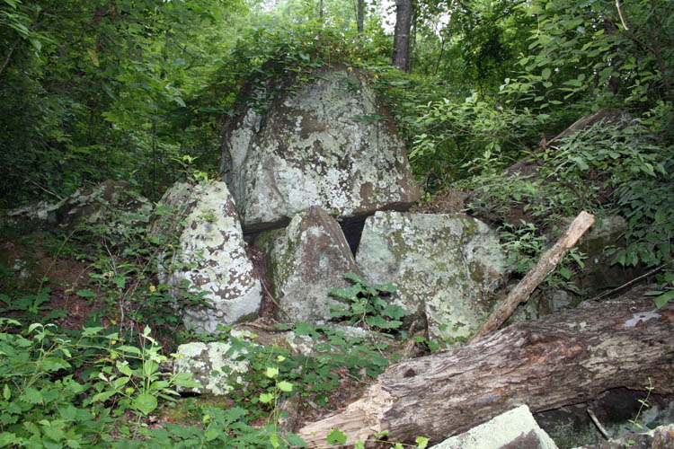
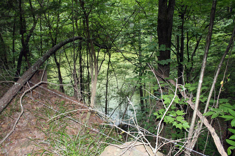
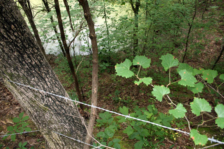
QUARRY POND
There is a good 30 feet plus drop off down to the water level. It
is no telling how deep the quarry was when it was in operation and has
filled in with debris and sediment over the decades as evidenced by a little
island near one end of the quarry pond. At this location, the
elevation is 350 feet above sea level according to Ralph's
Obamaphone. I call all cell phones Obamaphones, regardless
of their make/model and/or price, etc.
The coordinates at this view are: 34 degrees 59 feet 7 inches N and
80 degrees 5 feet 19 inches W
As a young lad, I
accessed the quarry from the western side across from the steep rock wall.
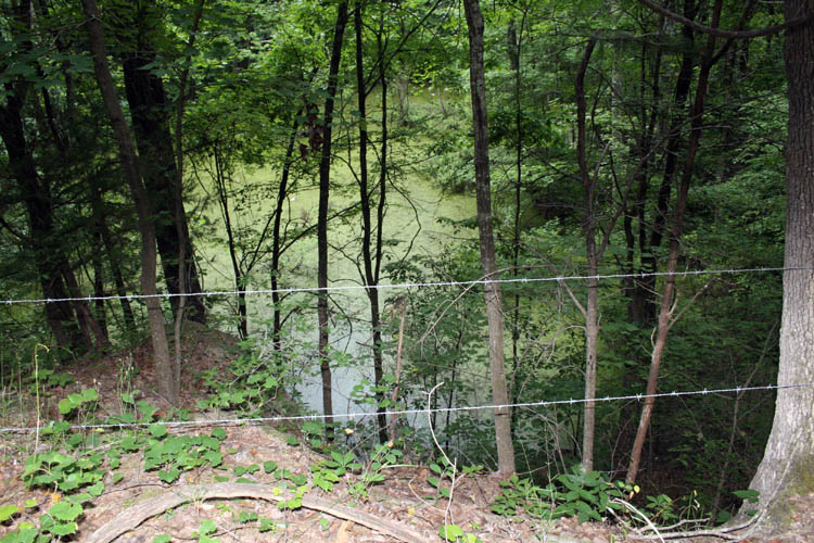
PIXS EXITING THE QUARRY SITE
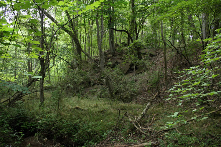
This area is prolific with large brownstones.
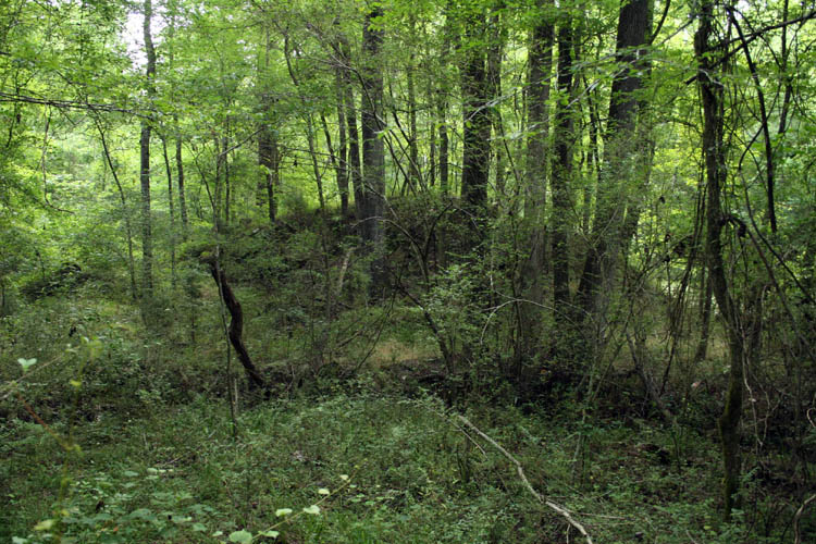
One thing if for certain, there are many thousands of tons of brownstone
still in the immediate vicinity of the ole quarry site.
The Brown Stone Quarry property is currently owned by Richard Lockhart &
Wife Effie C/O Juanita M. Joyner of Lawrenceville, NJ property pin #
647518410156,
Deed Book 91 Page 106.
According to the tax records, it is 30 acres deeded, but actually 31.5 acres
and has a section large enough for a road that ties directly into the Air
Line Railway property which makes sense for shipping stones out of the
quarry. At the time I visited the site in the middle to late 1950s, I
do not remember rail access to the site, but that does not mean it didn't
exist when the quarry was operational.
I think Ralph wants to go back in the fall and do further recon on the
site and it would be good to see what the view currently looks like from across the
quarry pond to the back side of the rock cliff wall. The ole rock
quarry site brings back a lot of my memories as a boy and they are still
fresh in my
“Mind’s eye” as then. The terrain in the 1950s where the
Anson Middle School now resides on
52N was nothing but broom straw fields and farm land and
"time waits for no one!"
and did my share of rabbit hunting with hounds and other small game.
We both were
soaking wet when we got back to the vehicle. I believe
we were gone about 1.5 hours and great to find the quarry site on the first
attempt.
Below is a pix of Ralph Henry Coble:
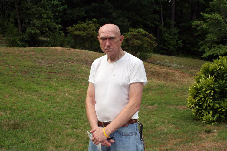
I am going to tell Ralph he needs to loosen up a little with a grin or
something.....grin if you must!
Web page published by Bill aka Mickey Porter on 06-05-19.
LEAVING ON A
SPIRITUAL NOTE
If you do not know Jesus Christ as your Lord and Savior, please take
this moment to accept him by Faith into your Life, whereby Salvation
will be attained.
Ephesians 2:8 - 2:9 8 For by grace are ye saved through
faith; and that not of yourselves: [it is] the gift of God: 9 Not of
works, lest any man should boast.
Hebrews 11:1 “Now faith is the substance of things hoped for,
the evidence of things not seen.”
Romans 10:17 “So then faith cometh by hearing, and hearing by
the word of God.”
Open this
link about faith in the King James
Bible.
Romans 10:9 “That if thou shalt confess with thy mouth the
Lord Jesus, and shalt believe in thine heart that God hath raised him
from the dead, thou shalt be saved.”
Open this
link of Bible Verses About Salvation,
King James Version Bible (KJV).
Hebrews 4:12 “For the word of God is quick, and powerful, and
sharper than any two edged sword, piercing even to the dividing asunder
of soul and spirit, and of the joints and marrow, and is a discerner of
the thoughts and intents of the heart.”
Romans 6:23 “For the wages of sin is death; but the gift of
God is eternal life through Jesus Christ our Lord.”
Romans 3:23 “For all have sinned, and come short of the glory
of God;”
Micah 6:8 “He hath shewed thee, O man, what is good; and what
doth the LORD require of thee, but to do justly, and to love mercy, and
to walk humbly with thy God?”
Philippians 4:13 "I can do all things through Christ which
strengtheneth me."